

Southwest Bolivia is what I imagine it would look like if you combined southern Utah with Yellowstone National Park and put them on Mars. Never in my life have I seen so many beautiful and mysterious sites–like the ancient coral reef above, 12,000ft high in the mountains.
Below are some highlights from a truly awesome experience in a place that hardly feels like you are on Earth.

A short day hike from the gateway town of Tupiza led us to slot canyons and red rock. Our official tour began the next day.
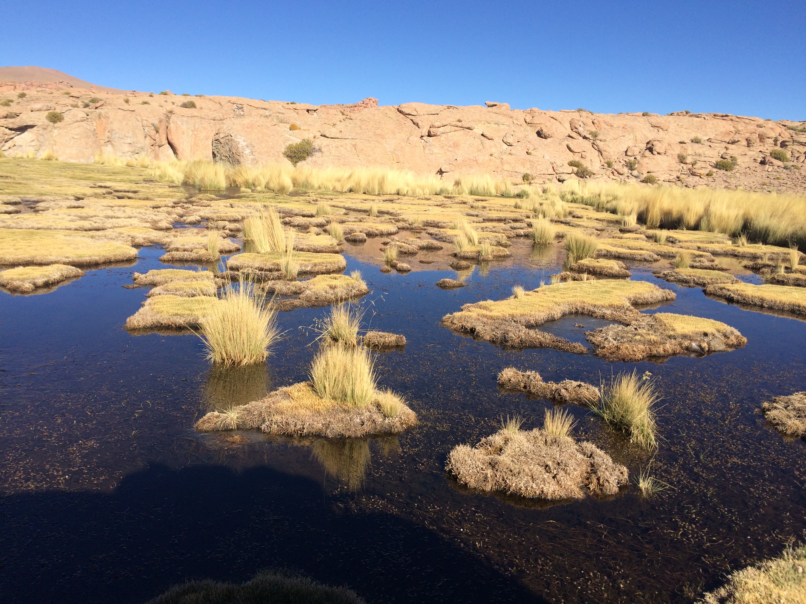
The tour began with high elevation “puna” ecotypes, similar to what we experienced on our anniversary hike in Peru.
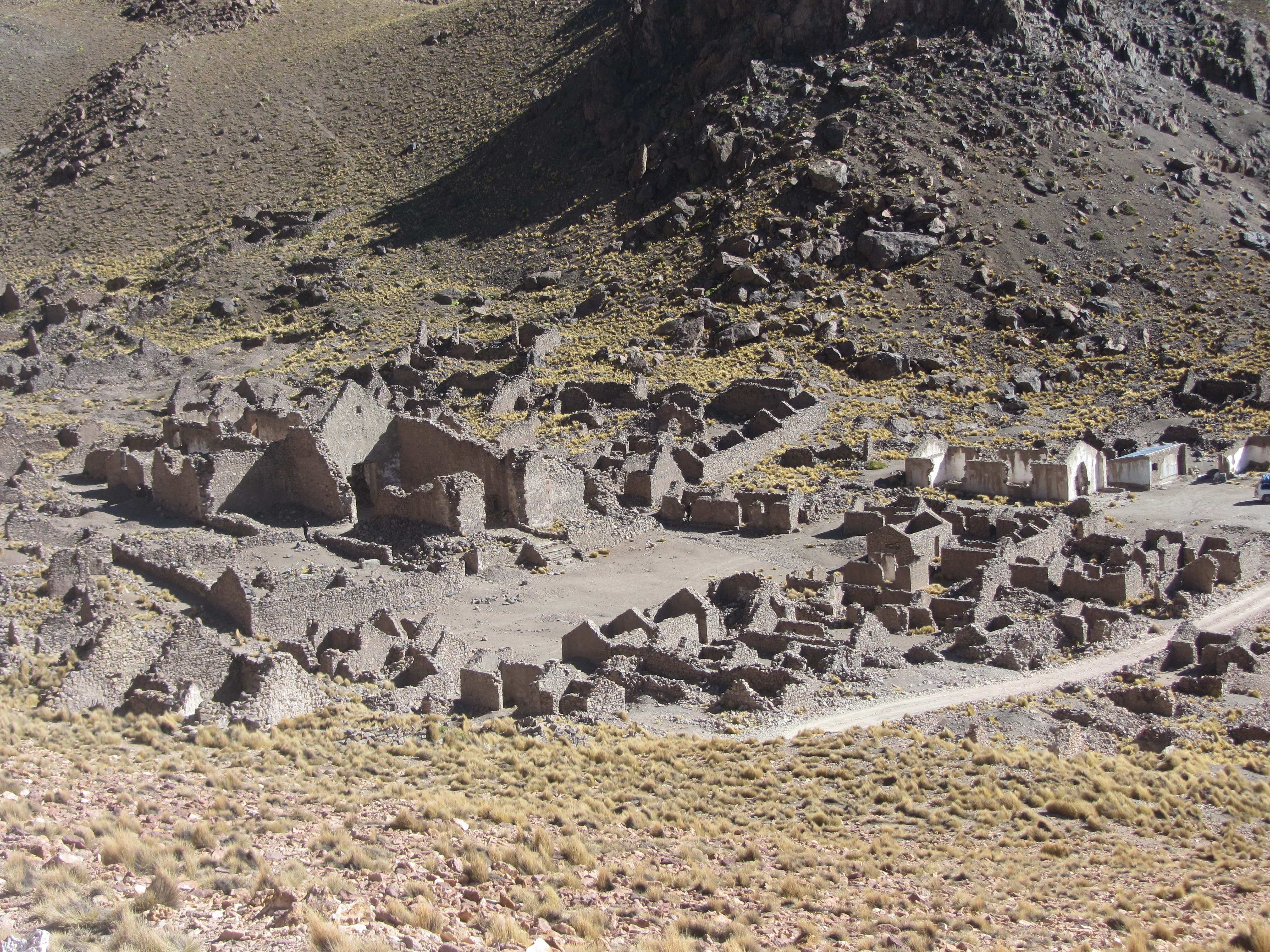
Ruins of a 500-year-old Spanish mining town that was abandoned because the ore turned back to rock, only to become silver again when the devil returns to the mountain. That is their story and they are sticking to it.
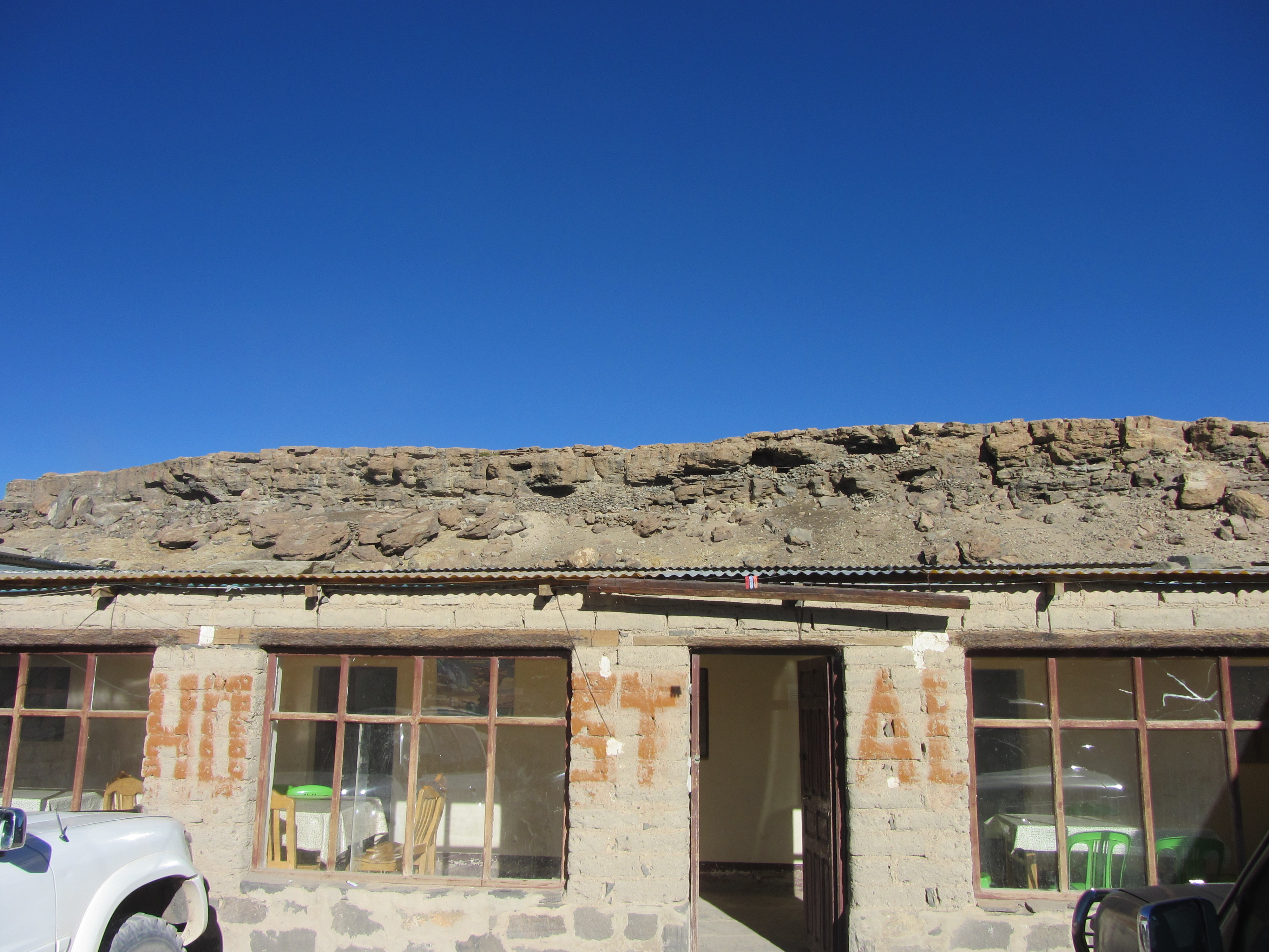
Just inside the Reserva Nacional de Fauna Andina Eduardo Avaroa, our first day ended in this building that has walls and a roof. It says “hostal” too, which is how you know that you are supposed to sleep there. Bringing a sleeping bag is required for the tour because the accommodations are, how shall we say, sparse?

On the second day things started to get crazy. We saw our first flamingos at the “Stinky Lake,” followed by a visit to Laguna Kollpa. This lake contains high amounts of sodium carbonate that is mined by two families who sell the white stuff to shampoo companies.


After a drive through the Dali Desert, so named for its surreal and colorful rock formations and volcanoes, we arrived at Laguna Blanca and Laguna Verde. Can you guess the English translation?

Surrounded by volcanoes in Chile on our right and in Argentina on our left, the colors of the desert changed from moment to moment.

Before lunch day two: we get to soak in 100 degree hot springs overlooking a massive 4,200 meter-high dried lake.

After lunch it was time for a visit to the highest geyser field in the world. Note the absence of boardwalks, ropes, or signs. It was like exploring Yellowstone 100 years ago.

We ended the day at Laguna Colorada, a stunning red lake. The color is created by the algae that rise to the surface as the temperature rises and winds increase each day.

2,000 James Flamingos call the lake home, and lay their eggs on the borax islands that dot the 80 square kilometer lake.

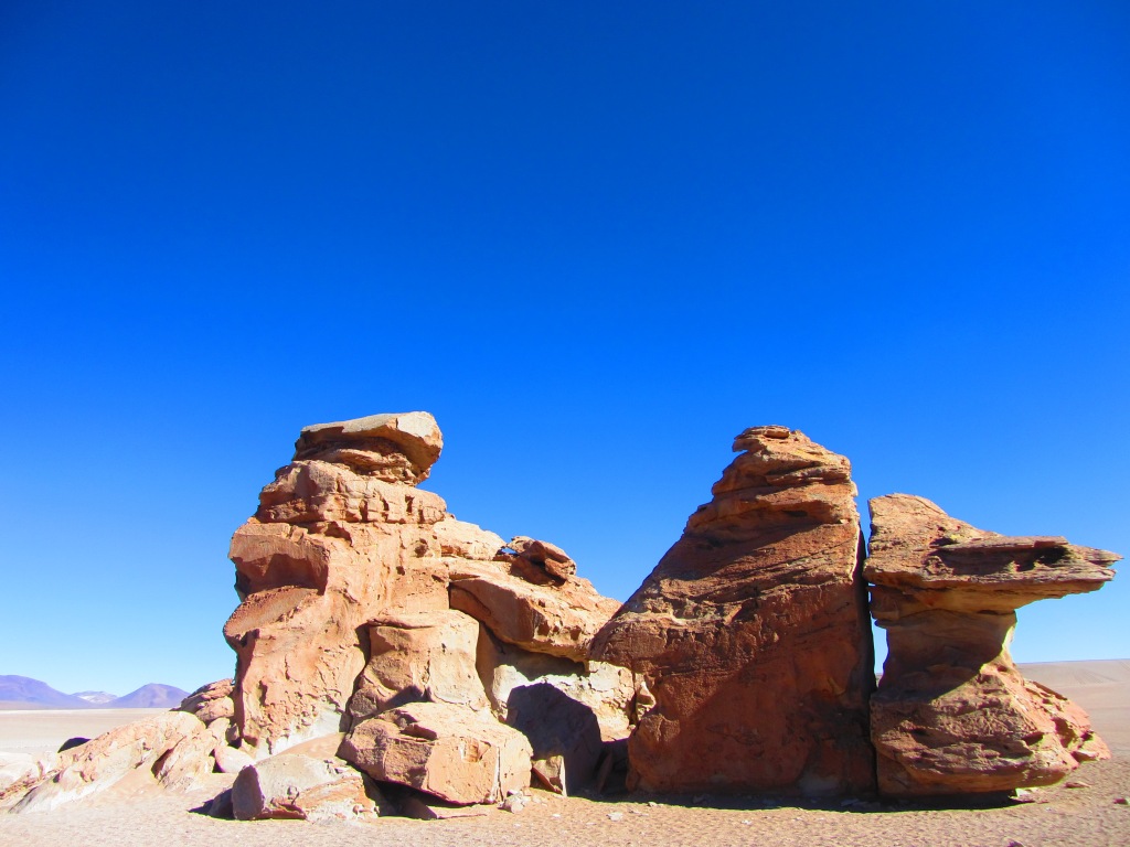
The third day began with a visit to some of the most ridiculous rock formations you have ever seen.


Followed by more beautiful lakes and more flamingos!

I’m convinced the Toyota Land Cruiser is the post-apocalyptic vehicle of choice.

We made some new friends, too. Daniel and Annie were great companions. Originally from France, they live in Quebec and hate the Alberta tar sands.

After learning about how this used to be an ocean and now the area near the Salar de Uyuni is a petrified forest of coral (some 2 meters or more tall)…

We visited a cave only discovered in 2002 that is filled with, you guessed it, petrified coral. We could not believe our eyes.


The pre-Inca people that inhabited this area apparently discovered the other side of the “coral cave” and used it to bury their dead in tombs (or chulpas) excavated carefully and then filled with gifts like coca leaves and quinoa. There are about 15 holes in this photo, and where I am standing is the small hole that locals enlarged in order to find the intact coral cave above.

We arrived at the edge of the Salar de Uyuni in the evening on day three and stayed in another basic building where nothing was special except one thing: it was built out of salt, including well-designed archways built out of salt bricks. And yes, I licked the wall of our bedroom.
The Salar de Uyuni
The common name for our tour is “the Salar tour.” And the Salar de Uyuni is supposedly the ultimate prize in your four-day journey. Yet Erin and I were so awed by everything else we saw, that our final day was more like the ganache layer in an already spectacular chocolate cake.
So, here we go:


We awoke at 4:30am to make it 45 minutes across the Salar to Isla Incahuasi in time for sunrise. The “island” is a volcanic mountain rising above the salt flat, covered in more petrified coral and thousands of saguaro-like cacti.

At 10,000 square kilometers, this is the largest salt flat in the world.

Behind Annie and Daniel is the most prominent volcano abutting the Salar (Volcan Tunupa), which provides an important directional marker in this land without roads.
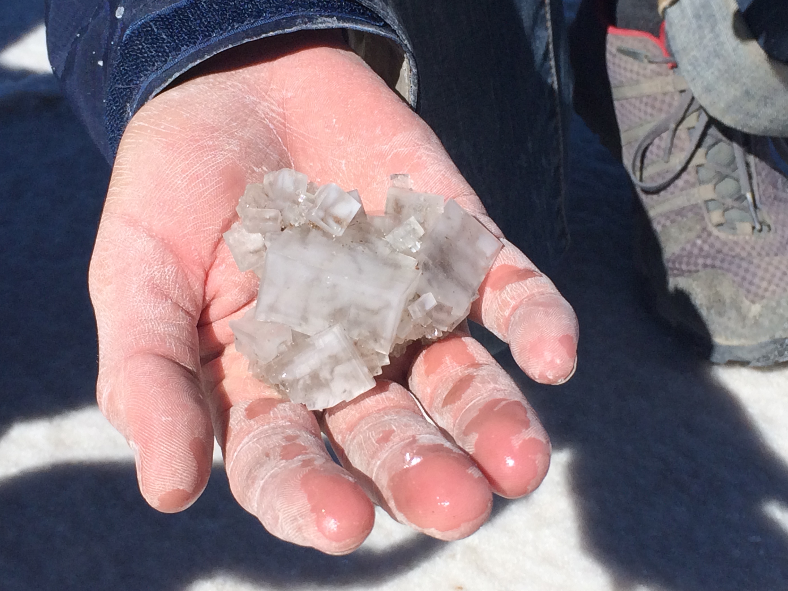
After the sunrise we drove another 20 minutes across the salt flats to an area where the salt layer is very thin and small holes in the crust (“Ojos de Agua”) appear. Our driver, William, and I dug around like little kids, cutting our hands as we explored the freezing cold and mineral-rich water underneath the crust, but salt crystals like this are the reward.
The silliest thing that the Salar is known for is its complete lack of perspective when photographed, which leads people to pose for photographs that look like…

…William pulling us out of a bag of coca leaves. Or…

…me balancing on our monkey.


Well, you get the point. We had great fun setting up these shots with the help of our awesome guide, Nancy. Our tour through SW Bolivia was a definite highlight of our trip so far.
New birds in Bolivia: bananaquit^, palm tanager^, swallow tanager^, purplish jay^, crested oropendula^, blue and white swallow^, versicolored barbet, speckled chachalaca^, house wren^, blue dacnis, tropical parula, rusty flowerpiercer, blue and yellow tanager, pale legged warbler, white bellied hummingbird, olive crowned crescentchest, golden billed saltator, hooded siskin, band tailed seedeater, greenish yellow finch, cliff flycatcher, white-winged black tyrant, black chested buzzard eagle, white banded mockingbird, andean swift, black hooded sierra finch, lesser rhea, james flamingo, plumbeous sierra finch, common miner, red backed sierra finch, andean avocet, andean flamingo, puna plover, crested duck, baird’s sandpiper (^ denotes birds seen in other countries previously on this trip)
