
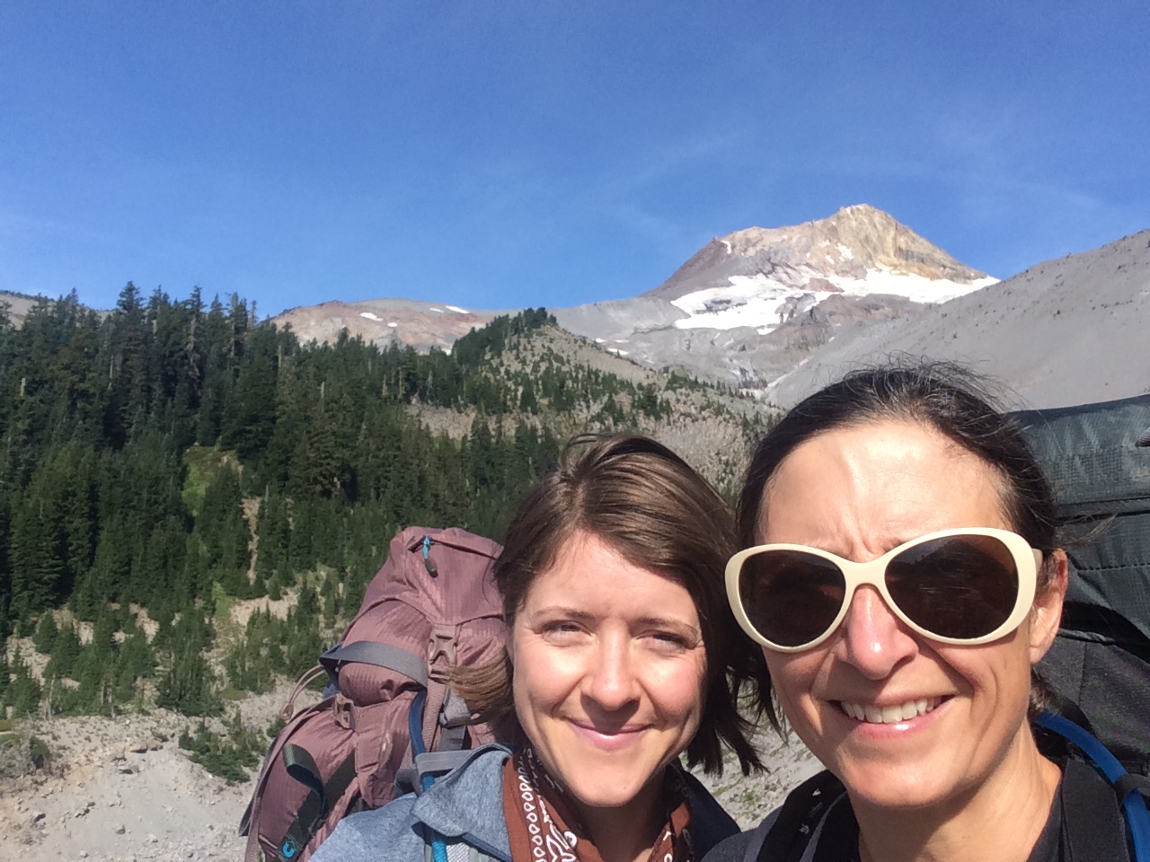
Don’t get me wrong. I love a good wine-fueled girls’ weekend. I’ve been to two amazing female gatherings in the forest and at the coast in the last 2 years. But this girls’ trip was different, full of wildflowers instead of wine and starring Oregon’s tallest peak, Mt. Hood. For this girls’ trip, my friend Val and I donned 35-pound backpacks and walked 40 miles around the highest point in Oregon.

I’ve wanted to hike the Timberline Trail, which encircles Mt. Hood, since I learned of its existence 20 years ago. But I just never got around to it and then in 2006, flooding of the Eliot Branch on the mountain’s east side destroyed the trail as it approached the canyon, making passage nearly impossible. It took 9 years for the Forest Service to repair the connection across the stream. And earlier this year, Val and I marked out four days on our calendars in August to finally trek all the way around Mt. Hood.
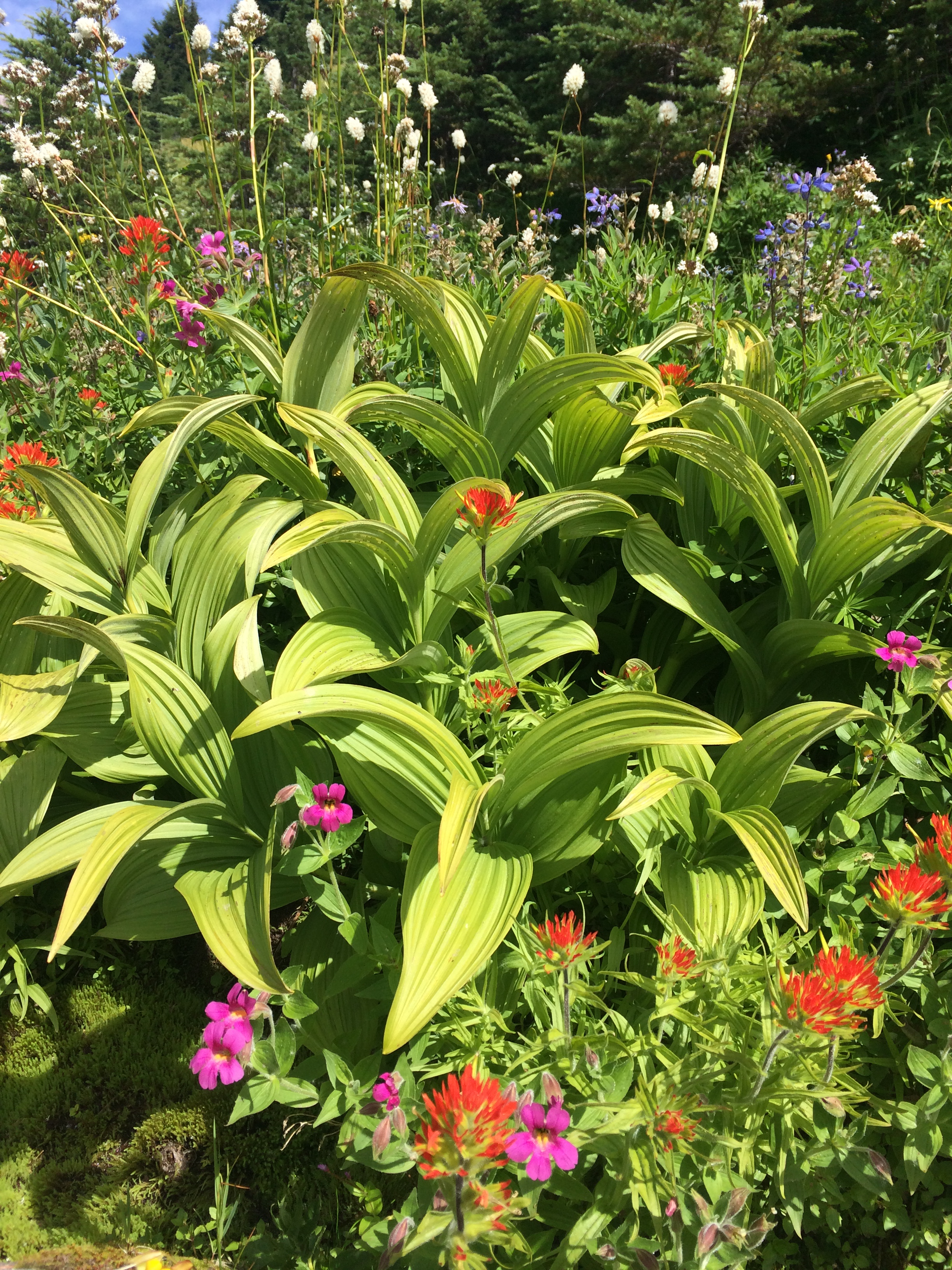
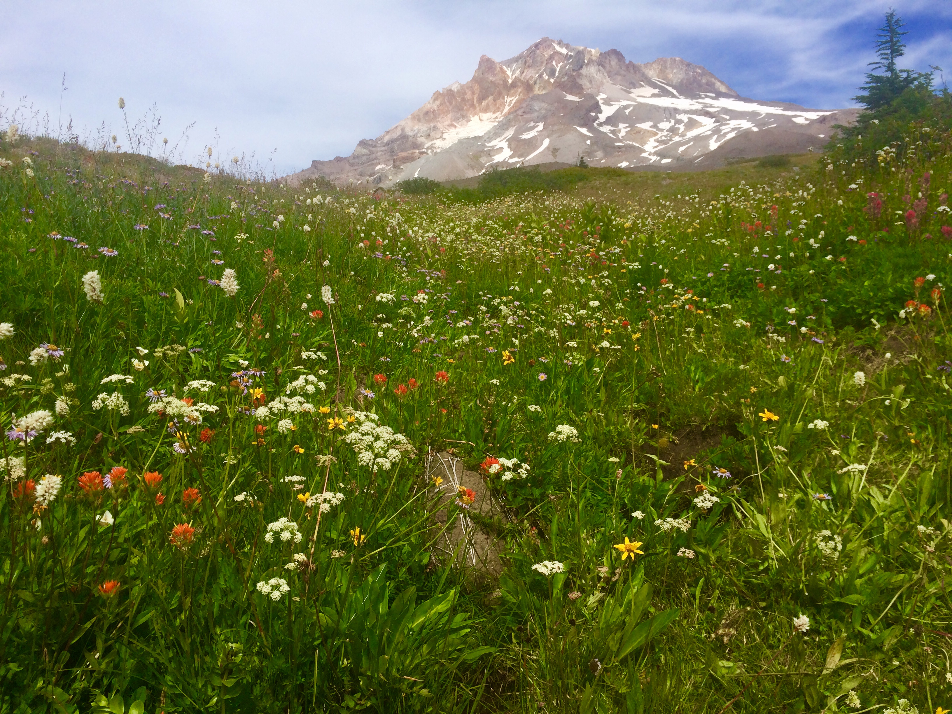
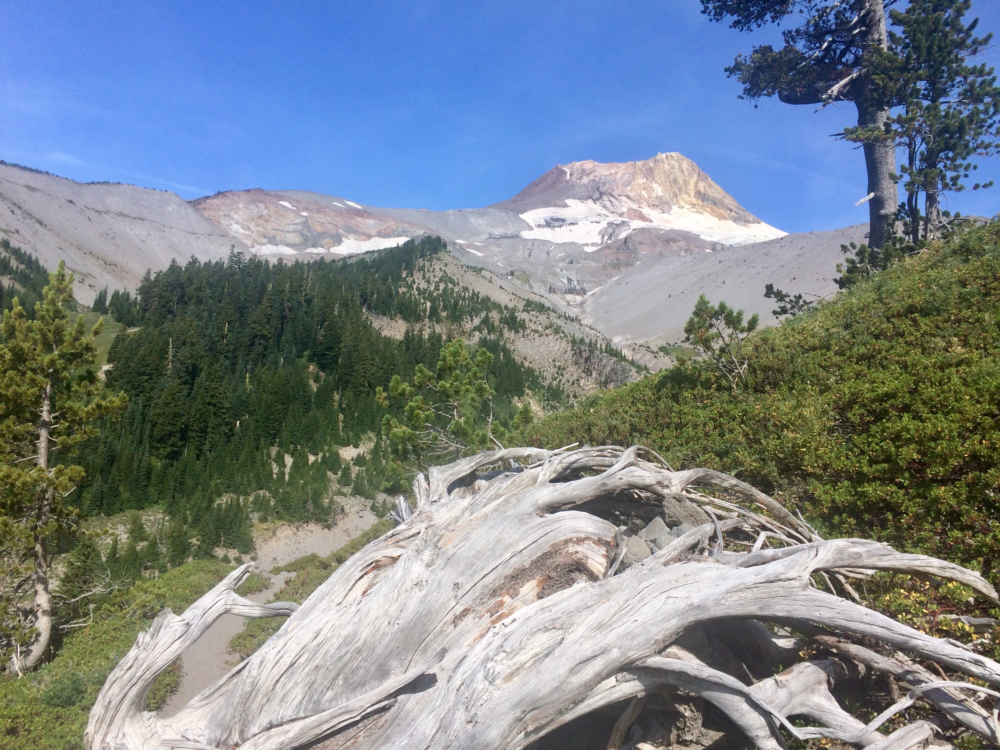
This trail through the designated Mt. Hood Wilderness is challenging and sometimes grueling as you climb in and out of glacier carved canyons, wade through icy runoff on 8 major creeks and rivers, and clamber across snowfields. But it is also spectacularly beautiful, filled with a rainbow’s assortment of wildflower meadows and a million dollar view around every corner.

We set off as most do, from Timberline Lodge, a National Historic Landmark on the south flank of Mt. Hood, built by the Works Project Administration between 1936 and 1938. We stood on the front steps of the lodge before setting off and asked a woman to take our photo. She asked where we were headed and got very excited for us when we told her our plans. She too had dreams of circumnavigating the mountain.

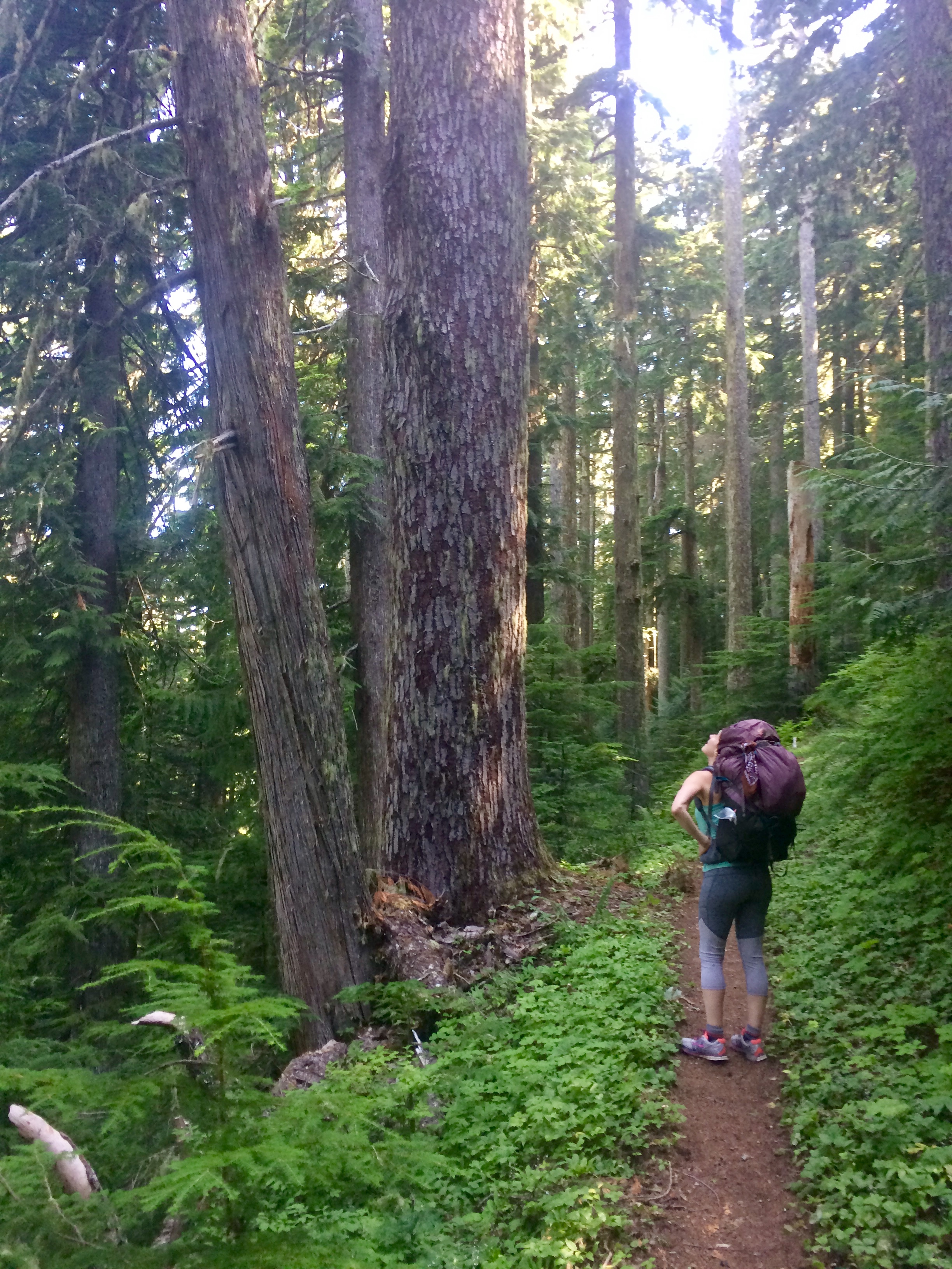
The sun shone bright as we traversed under the ski lifts next to the Lodge before leaving civilization behind for four days. We darted in and out of white pine and subalpine fir forest at tree-line, bright violet lupine lining the trail.
Our first major stream crossing at the Zig Zag River went off without a hitch and we proceeded on to the aptly named Paradise Park, taking the alternate route through its technicolor wildflower meadows.
We had just passed a foursome lazing in the sun and enjoying their lunch, when we heard a noise. A very distinct yowl came from a small grove of trees off the right side of the trail ahead. We stopped in our tracks and confirmed that we both just heard what was clearly a cougar, then went silent in time to hear a short, high pitched, “meow” come from the same spot. We quickly turned around and headed back to the lunching hikers who had also heard the roar, but not what we can only assume was the sound of its cub that followed. Agreeing that there was strength in numbers, we retraced our steps, passed the grove of trees as a band of six and continued on down the trail. We never got a glimpse of the cat, but I’m sure she saw us.

The final test of Day 1 was crossing the glacial waters of the Sandy River which was rushing and wide this late in the day. After watching a couple of folks shimmy on all fours across some narrow logs, we opted to doff our shoes and socks and wade across. It was damn cold, but thankfully a quick crossing. We set up the tent on a forested shelf above the river, ate dinner and were in our sleeping bags by 8pm.
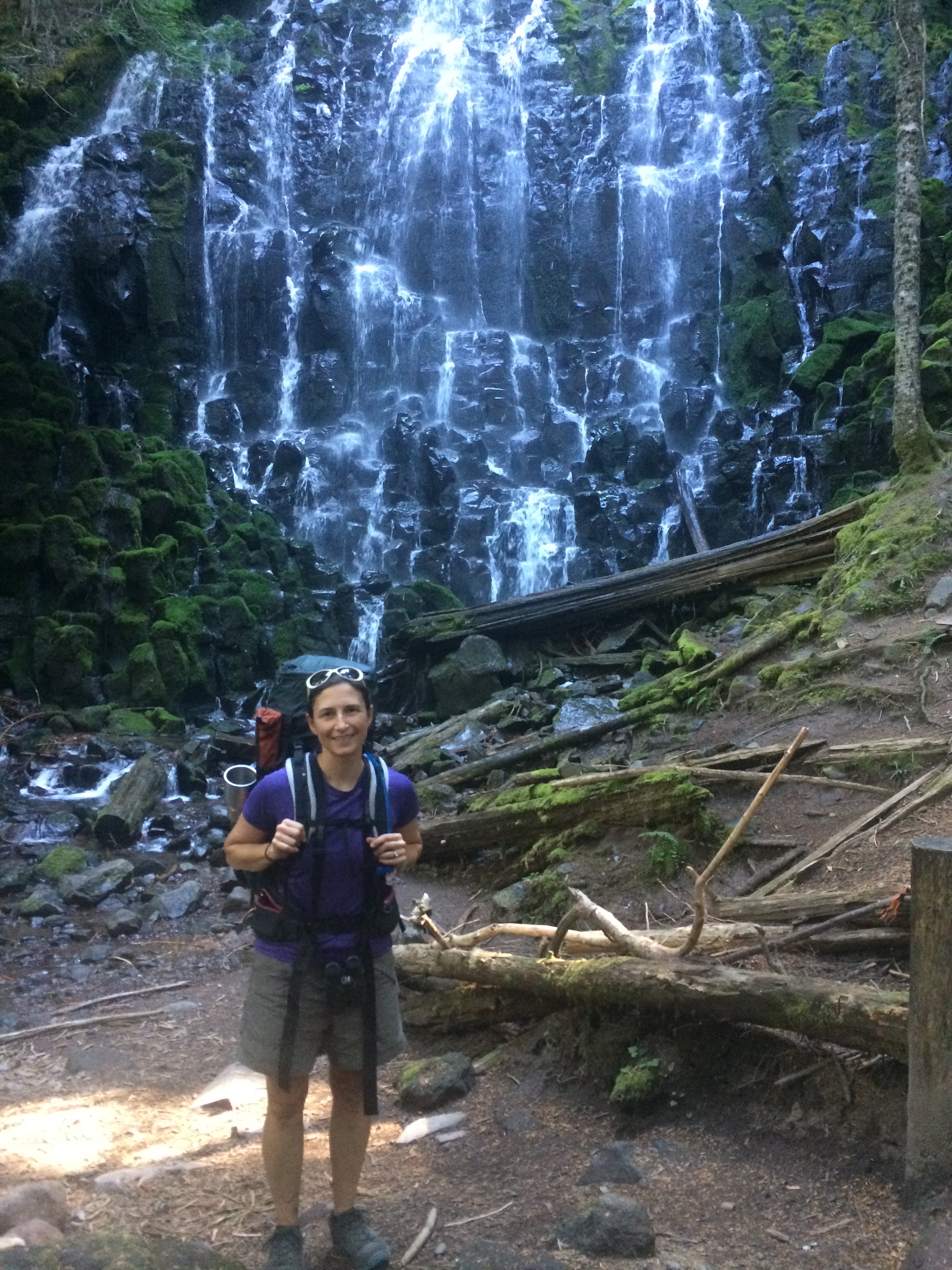
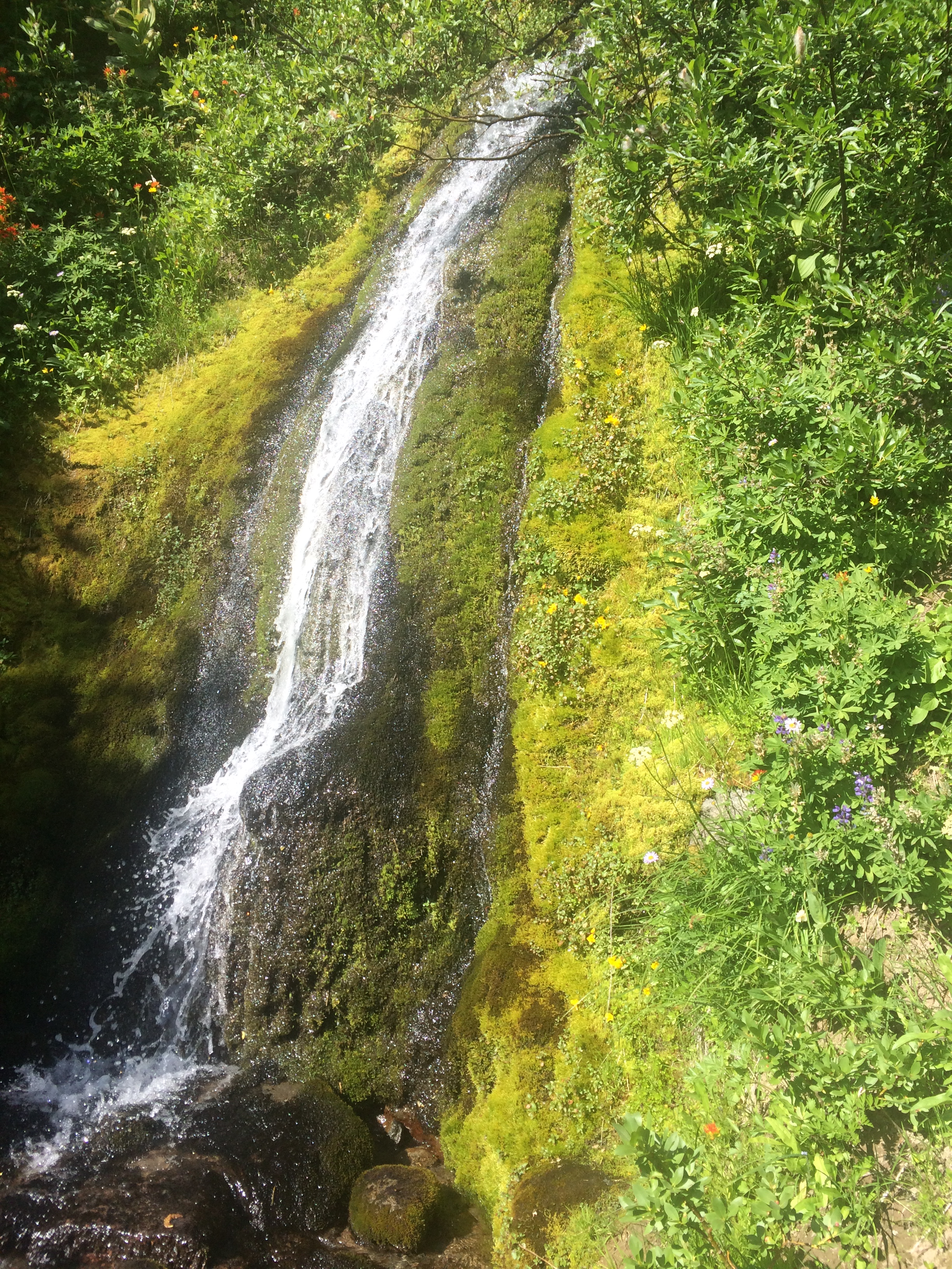
Day 2 started with the ethereal Ramona Falls at the lowest point of the Timberline Trail. We stopped to snap a few photos before heading out to what turned out to the be the most difficult stream crossing of the trip.

Arriving at the first of several channels of the Muddy Fork of the Sandy River, we surveyed for an easy route to cross. None apparent, Val decided to toss her pack across the channel and then rock hop across. But as she went to release her pack, she realized it wasn’t going to clear the stream. She held on as the weight of the pack pulled her chest-first onto a log with a perfectly placed nub that struck her sternum, as her pack hung precariously over the small rapid below, water licking at its base.
I was flailing to dislodge my hands from my hiking poles, unsure whether to grab her or her pack first. I chose wrong and grabbed her legs. “My pack!” She yelled over the rushing water. “Grab my pack!” Together we hoisted her pack on shore and assessed the bodily damage. A nasty welt slashed across her chest and bruises bloomed on both legs, but no bones appeared broken. We carefully crossed on a few large boulders, a crossing which, in hindsight, required no heroic measures and took a well deserved break on the other side.
After confirming our initial assessment of the injuries, we set out again, enjoying spectacular views of the northwest side of the mountain and its craggy lower ridges, through the old growth noble fir stands on the north side of Bald Mountain…
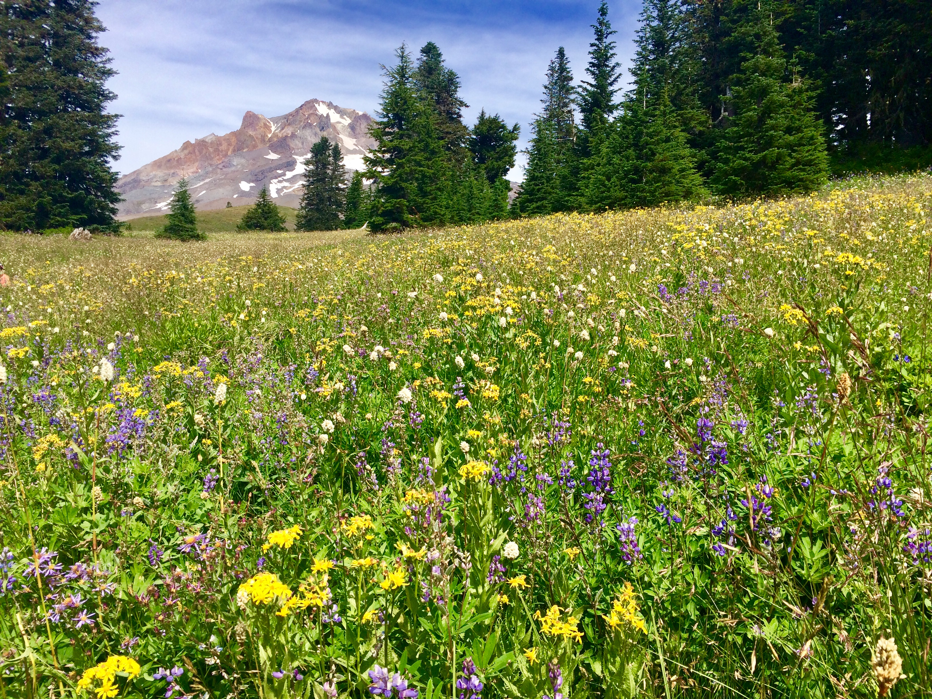
…to the multiple wildflower strewn basins (Cairn Basin, Eden Park, Wy’east Basin, and Elk Cove) on the north side of the mountain.


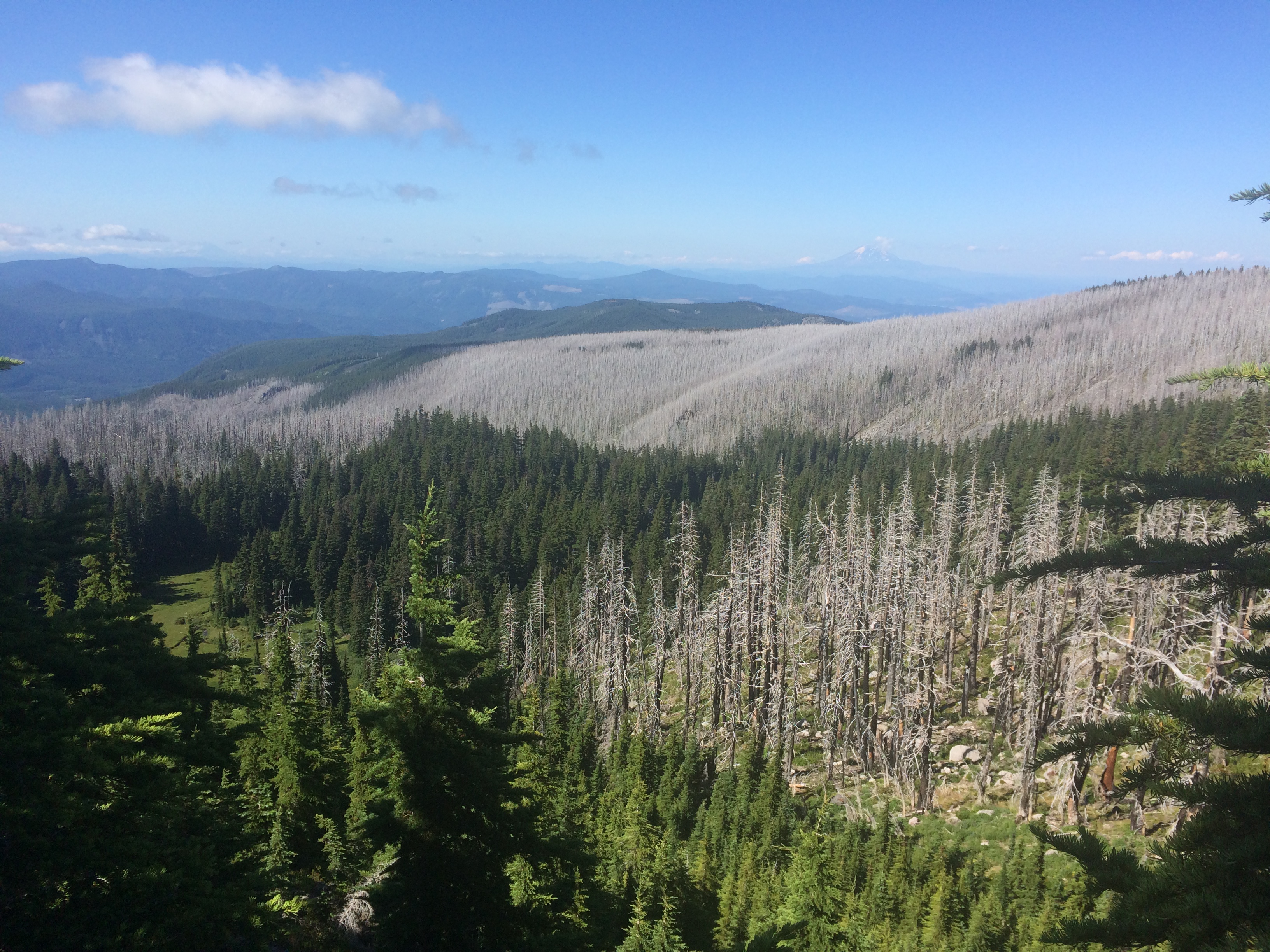
We snaked in and out of the charred trees of the 2011 Dollar Lake Fire, reborn in fireweed and huckleberry bushes before setting up camp on a bench above the pink and yellow monkey flower lining Cove Creek. I was asleep before the sun fully set.


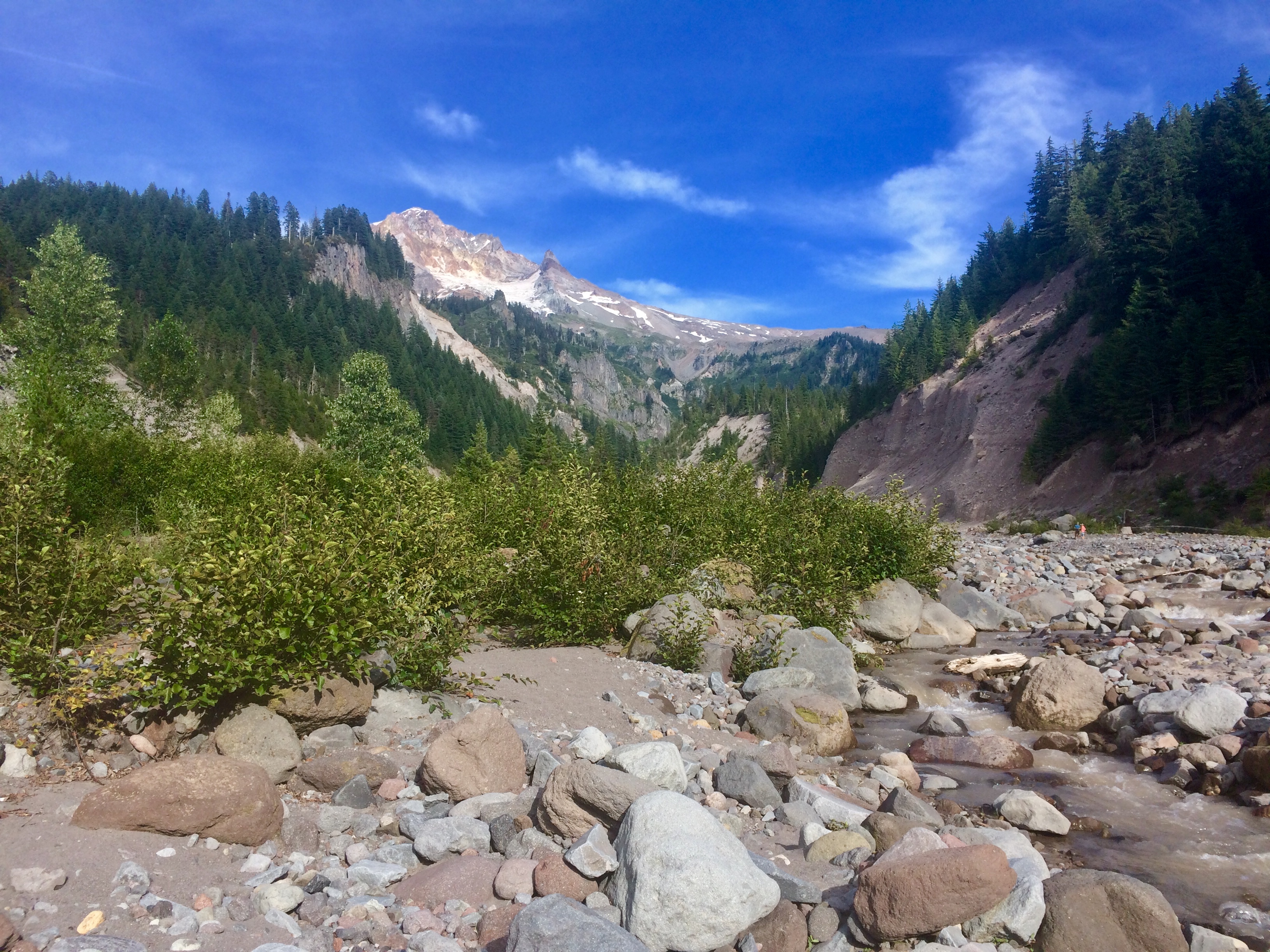
My biggest worry of the whole trip was the crossing of Eliot Creek on Day 3. This is the one that blew out its banks in 2006, decimating the trail. We continued our path through the fireweed fields and blackened trunks of the Dollar Lake fire on our approach to the creek.
We heard it long before we saw it, a bass filled thumping, and mid range whooshing signifying its proximity. Once it came into view, it appeared huge, multiple short tiered waterfalls channeling thousands of silt-filled gallons down the canyon. Boulders the size of small vehicles perched on the top of the canyon walls, above the trail, deposited there by the creek’s raging flood waters.
We picked our way sloooowly down one side of the rock and gravel filled slope, and off the new trail, on a user created trail towards a large log that provided a relatively easy crossing of the water as we tried not to think about the unconsolidated fill hanging above us or the raging water below.

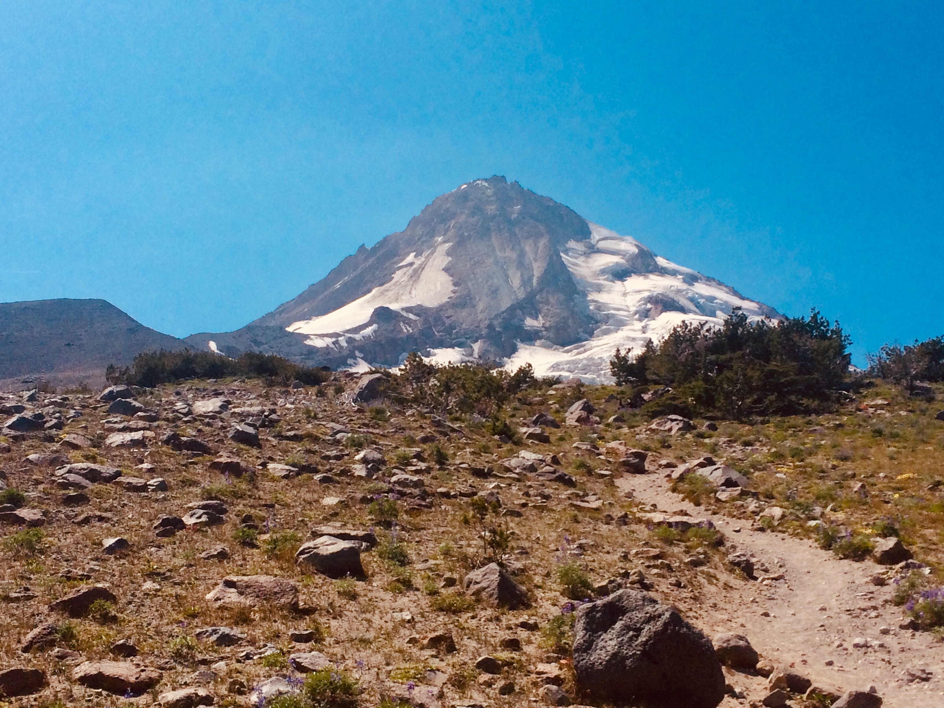
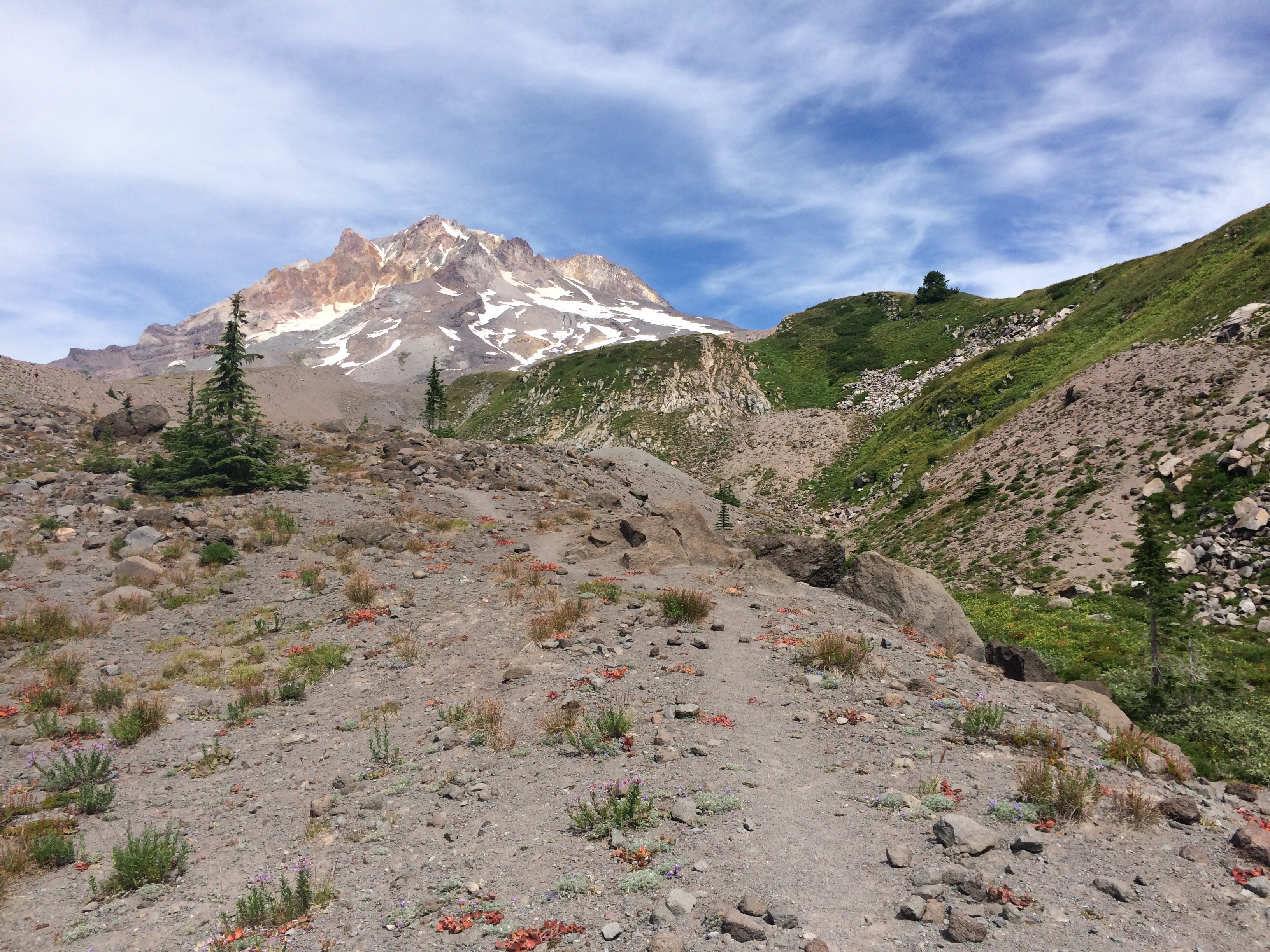
Once across we easily joined the trail for the long steep climb through the forest on the other side. We enjoyed lunch at the picnic tables of the Cloud Cap campground, before making another steep climb to the high point of the trail at 7,350 feet. At this point, you are above tree line, diminutive plants and wind ravaged shrubs are the only vegetation at this elevation, the mountain looming massive to the west.
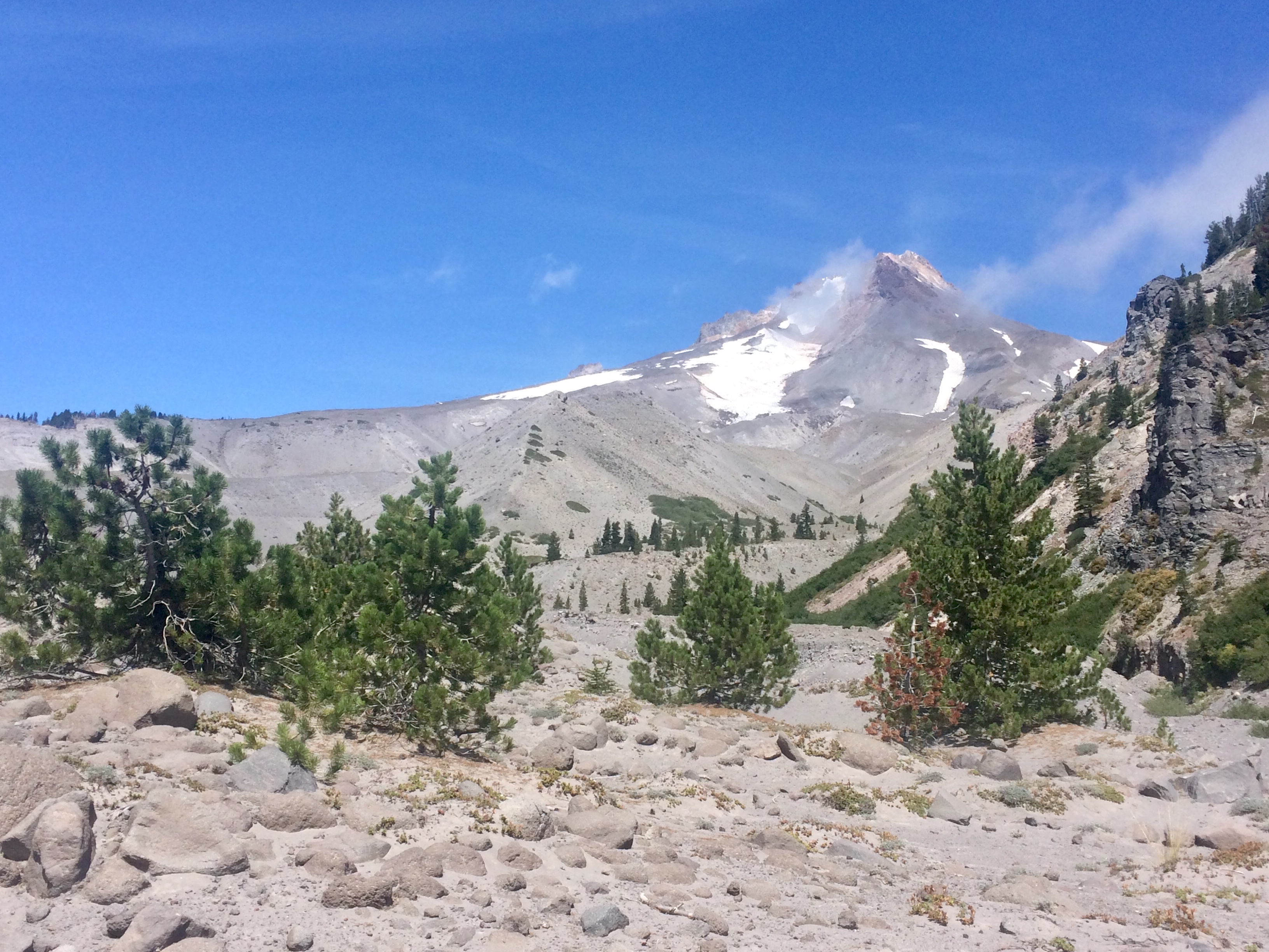
We crossed three snowfields carefully and gazed out at Oregon’s high desert to the east. Eventually we came to the high point of Gnarl Ridge, another appropriately named feature of the mountain, and one of the most stark, yet beautiful views of the entire trip.

We were feeling good today, so we pushed beyond our planned camp along the top of the ridge. As we were nearing our last creek crossing of the day, I lost my footing on the trail, my 30 plus-pound pack made defying gravity impossible. My knees and left elbow took the brunt of the fall, but only some minor scrapes and bruises resulted.
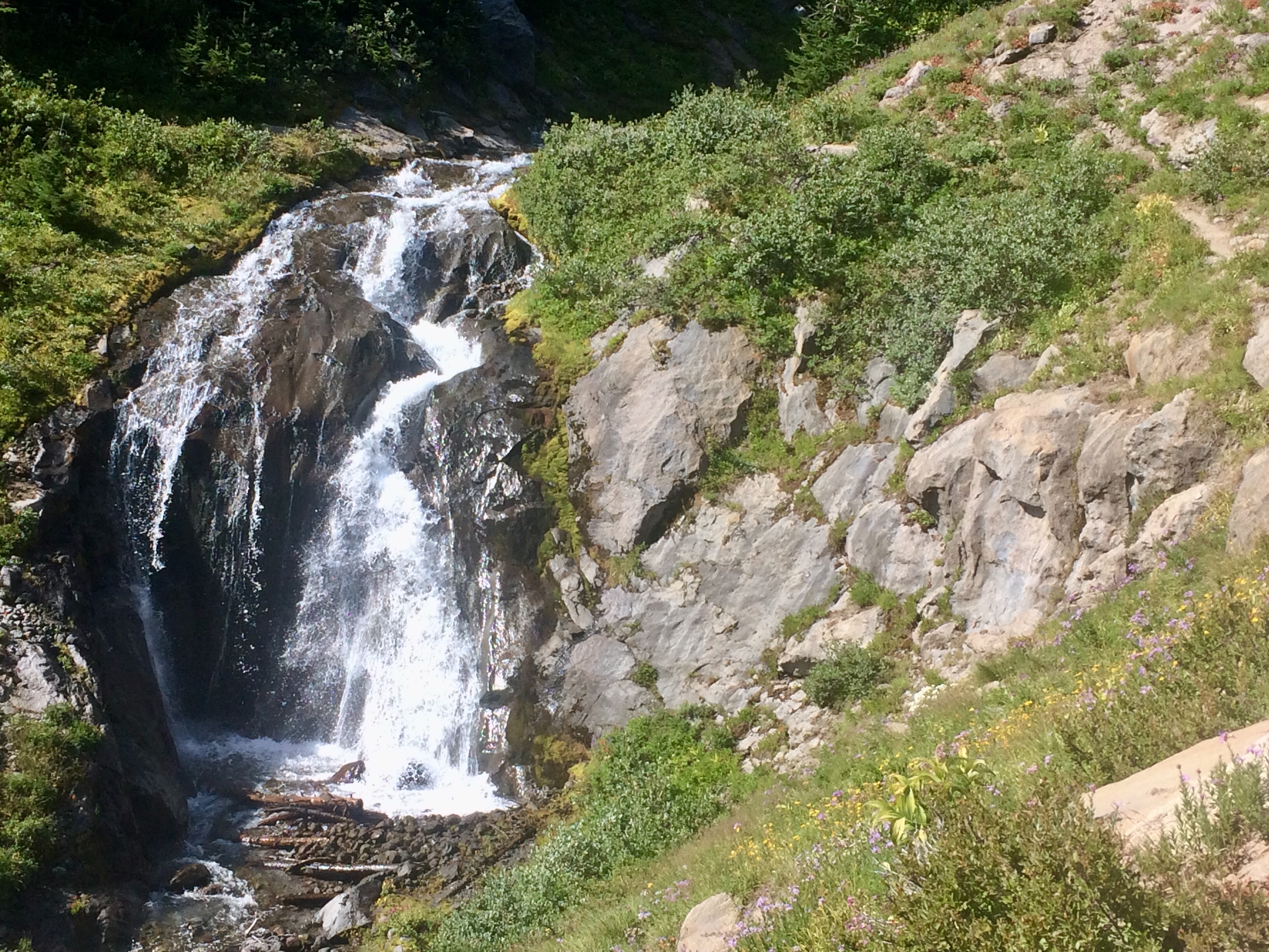
We made the difficult crossing of Newton Creek on a raft of narrow branches, before making camp at the headwater spring of a small drinking water stream. This was our most picturesque camp of the trip, a gunmetal grey wall of stone along Gnarl Ridge 500-feet above us as the backdrop.

Our feet were a bit worse for wear at this point, but with only 8 miles to go, we didn’t dwell on them too much.

After another 10+ hour night of sleep, we were ready for our last day on the trail. The weekend trail runner parade began at about 7:30 a.m. as svelte marathoners jogged past with nothing but their drinking water on their backs. Some do the entire trail in one day!
We set off about 8:30 a.m., images of pizza and a giant green salad filling my head. More stunning wildflowers and picturesque waterfalls capped off our last day on the trail as we crossed the Mt. Hood Meadows ski area with Val daydreaming about snowboard days ahead.
And finally, into the rock filled moonscape of the monstrous White River canyon about a mile before Timberline Lodge.
We made it back to the car about 1:30 p.m. feeling exhausted and like super bad asses at the same time. It was one heck of an atypical girls’ trip!

Exciting, exhilarating and awesome….to read about! Photos are breathtaking. Happy you made it home safely. Thanks for sharing!
LikeLike
Sounds absolutely amazing! So proud of you ladies!
LikeLike
Another amazing entry in the wonderful “Lower the Bar” series.
LikeLike
Great adventure- thanks for a vicarious personal journey
LikeLike
Thank you, Erin, for your new and interesting post. Instructive, accurate and fun story about the American wild nature lands. I encourage you to publish a travel guide book collecting all your posts. It will surely be a success. XX Alvaro.
LikeLike